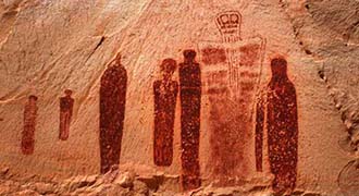
Ancient architects created a global network of temples and megaliths as mirrors of perfection. With an unerring knowledge of the mechanics of nature, these magicians built sacred sites to outlast the ravages of time and human folly. They understood the flow of subtle energy, located its hotspots, and applied a combination of geomancy, sacred geometry and earth magic to create living spaces capable of influencing consciousness.
For three decades I've researched countless temples and megalithic sites, and discovered they act as intermediaries between the material and the spiritual — portals, the ultimate self-help centers.
Behind every pyramid and stone circle there exists a symbolic language containing the keys to ancient systems of knowledge, codes of creation, sound, and how these can be applied to influence the everyday world. It is an insurance policy for when we forget why we are here.
Sages, scholars, mystics, even the Knights Templar have applied this knowledge. My research will make you aware of this legacy so that you may improve the quality of life aound you. And within.


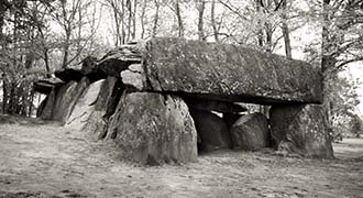
Ever wondered why stone used in megalithic temples is not of local origin? Or why you get electric shocks from dolmens, menhirs and other standing stones? Well, there's a science behind it. Read more…
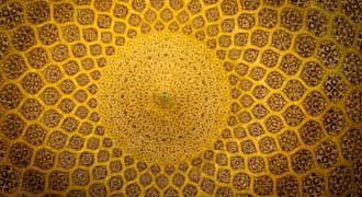
Sacred geometry was used to generate a specific energetic environment inside a temple. It’s one reason why pyramids may look alike yet each feels different. And this geometry resonates with your DNA. Read more…
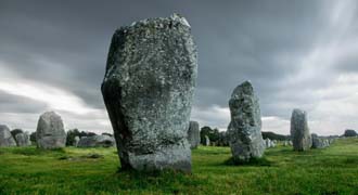
Megalithic sites are precisely aligned to each other, to stars, planets, even constellations, by the art of ley lines. Find out what these are and how they differ from telluric currents (electromagnetic energy). Read more…
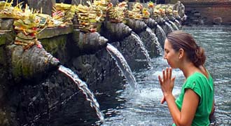
Water covers two-thirds of the planet and the human body. It is also the primary building block of every temple. Is this why water in sacred sites is more potentized than ordinary water? Read more…
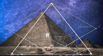
There is measure and then there is sacred measure. The architects of ancient temples distilled a numerical system based on the laws of nature, then applied it in stone circles and pyramids. Read more…
No, it's not your imagination, you do see unusual things in ancient sacred sites. Each one is a junction box for the Earth’s telluric currents, and their effect on your state of awareness is profound. Read more…
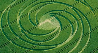
Crop circles are a misunderstood phenomenon. Given the distorted media bias, it's no wonder. Solid research proves that not only are they not made by people, they are also linked to ancient sacred sites. Read more…


